


Map Marketing Postal Districts of London Map Unframed 1 Mile to 1 inch Scale W1180xH930mm Ref GLPC 053378

| Description | Product Information |
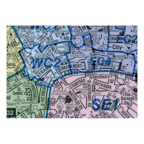
Map Marketing Postal Districts of London Map Unframed 1 Mile to 1 inch Scale W1180xH930mm Ref GLPC
- Postcode maps are an essential resource to assist with business planning
- Scale: 1:64,221 (1 mile to 1 inch)
- Size: 1180x930mm
- The London Low Emission Zone and Congestion Zone boundaries are both shown on the map Beaconsfield
- This map is double-sided, the reverse of the map is coloured coded by Borough instead of showing postcodes
- This map is permanently bonded between two sheets of tough, flexible, crystal-clear plastic. This finish allows you to write on, wipe off with dry or wet wipe pens
- Concentrates on highlighting the Postcode Districts (the first part of the Postcode or Outward Code) within Greater London. The roads are less highlighted to ensure that the Postcode information takes precedence
- Each Postcode area within Inner London is shown in a different colour for easy reference, Outer London is colour coded by County
- Main roads are numbered and named and underground and mainline train stations are shown along with major sporting venues
Consumer Delivery Expectation: Next working day
| Product code | 053378 |
|---|---|
| OEM code | GLPC |
Brand
| Map Marketing |
|---|---|
Manufacturer
| Map Marketing |
On Promotion
| No |
Region
| Greater London Street Map |
Type
| Maps |
Dimensions
| 1180x930mm |
Frame
| Unframed |
Region
| London Street Map |
Laminated
| Yes |
Scale
| 1: 64,221 |
Recyclable
| No |
Scale
| 1:64,221 |
Surface
| Drywipe & Wetwipe |
Warranty
| 12 Months |
No promotion items found.
|
| ||||
People who bought this, also bought:
Top 10 best selling products of Office DEPOT Ireland
Back to Top